Latitude and longitude are geographic coordinates: a pair of numbers that gives an exact "address" for any point on a map or globe. Latitude is measured from the equator, longitude from the prime meridian, and together they let you locate anything on Earth — from your home city to an uninhabited island. This page gives a clear explanation with a map diagram, the rules for writing coordinates, worked examples, and an interactive trainer.
What are latitude and longitude
Every map and globe has a coordinate grid — lines that cross like squares on a chessboard. The horizontal lines are called parallels, the vertical lines are meridians. Coordinates are read from them:
- Latitude shows how far a point is from the equator, to the north or south. It's measured along parallels: every point on the same parallel has the same latitude.
- Longitude shows how far a point is from the prime meridian, to the east or west. It's measured along meridians: every point on the same meridian has the same longitude.
Both coordinates are measured in degrees (°). Just as a chessboard square has an address made of a letter and a number (e2), every point on Earth has an address made of latitude and longitude: for example, Moscow's is 55° N, 37° E.
Latitude: the equator and parallels
Latitude (denoted by the Greek letter φ) is the distance in degrees from the equator to a point. The equator is the longest parallel: it divides Earth into the Northern and Southern Hemispheres, and its latitude is 0°.
- Moving north from the equator, latitude grows from 0° to 90° — this is north latitude (N). 90° N is the North Pole.
- Moving south from the equator, latitude also grows from 0° to 90°, but this is south latitude (S). 90° S is the South Pole.
Latitude can never exceed 90°: there's nowhere further to go past a pole. The closer a parallel is to a pole, the shorter it is — on a globe you can clearly see parallels "shrinking" to a point near the poles.
Longitude: the prime meridian
Longitude (denoted by λ) is the distance in degrees from the prime meridian to a point. The prime meridian is, by international agreement, the meridian running through the Royal Observatory in Greenwich, London — which is why it's also called the Greenwich meridian. It divides Earth into the Eastern and Western Hemispheres.
- East of Greenwich, longitude grows from 0° to 180° — this is east longitude (E).
- West of Greenwich, longitude grows from 0° to 180° west longitude (W).
The 0° and 180° meridians are two halves of the same circle: the 180th meridian runs through the Pacific Ocean and roughly follows the International Date Line. Unlike parallels, all meridians are the same length, and each one connects the North Pole to the South Pole.
A map with latitude and longitude: the coordinate grid
Here's what a full world coordinate grid looks like. Find the equator and the prime meridian on the diagram — they're the starting point for all measurements, and the labels on the map's frame give you the latitude and longitude values. Moscow is marked as an example: the dashed lines show which frame labels the point lines up with.
How to find latitude and longitude on a map
Finding the coordinates of any point comes down to four steps:
- Locate the point on the map and see which parallels and meridians it falls between.
- Find the latitude. Parallel values are labeled on the map's side frame. A point above the equator has north latitude, below it — south latitude. If the point falls between two parallels, estimate its position by eye: a point halfway between 40° and 50° has a latitude of about 45°.
- Find the longitude. Meridian values are labeled on the top and bottom frame. A point to the right of the prime meridian has east longitude, to the left — west longitude.
- Write the coordinates following the format in the reference box below.
To solve the reverse problem — finding a point from known coordinates — follow the steps in reverse: locate the right parallel, then the right meridian; the point you're looking for sits where they cross.
How to write coordinates
Below is the standard order for writing coordinates: latitude first (with its hemisphere), then longitude (with its hemisphere).
Special parallels and meridians
A few lines on the coordinate grid have their own names — they mark the boundaries of Earth's light zones and serve as landmarks in map exercises.
| Line | Coordinate | Known for |
|---|---|---|
| Equator | 0° latitude | The longest parallel, dividing Earth into the Northern and Southern Hemispheres |
| Prime (Greenwich) meridian | 0° longitude | Runs through the Royal Observatory in Greenwich, London, dividing Earth into the Eastern and Western Hemispheres |
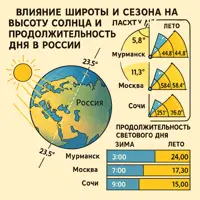
| Tropic of Cancer | 23.5° N | The northernmost parallel where the sun can appear directly overhead |
| Tropic of Capricorn | 23.5° S | The southernmost parallel where the sun can appear directly overhead |
| Arctic Circle | 66.5° N | North of it, polar day and polar night occur |
| Antarctic Circle | 66.5° S | South of it, polar day and polar night occur |
| 180th meridian | 180° | Opposite the prime meridian, it roughly follows the International Date Line |
Examples: finding latitude and longitude
Example 1. The coordinates of Moscow
Task: find the coordinates of Moscow on a world map.
Step 1. Locate Moscow and check the nearest parallels: the city sits above the 50° parallel, close to the 55th. Moscow is north of the equator, so its latitude is north: 55° N.
Step 2. Check the meridians: Moscow is east of the prime meridian, between 30° and 40°, closer to the 37th. The longitude is east: 37° E.
Step 3. Write it down, latitude first: Moscow — 55° N, 37° E (more precisely 55°45′ N, 37°37′ E, but whole degrees are enough for a school map).
Example 2. The coordinates of Sydney — a point in the Southern Hemisphere
Task: find the coordinates of Sydney (Australia).
Step 1. Sydney is below the equator — south latitude. The nearest labeled parallel is 30° S, and the city is slightly further south: 34° S.
Step 2. Sydney is far east of Greenwich, near the 150° meridian: 151° E.
Answer: Sydney is at 34° S, 151° E. Note that points in the Southern Hemisphere must always be marked "S" — without that letter, the coordinates would point to a different place on the planet.
Example 3. The reverse problem: what's at 30° N, 90° W
Task: find out what city sits at the coordinates 30° N, 90° W.
Step 1. Latitude 30° N — find the 30° parallel in the Northern Hemisphere (above the equator) and trace it with your finger.
Step 2. Longitude 90° W — find the 90° meridian to the west (left) of the prime meridian.
Step 3. At the intersection of the parallel and meridian is the mouth of the Mississippi River and the city of New Orleans (USA).
Checking hemispheres: 30° S, 90° W is the Pacific Ocean, while 30° N, 90° E is the Himalayas. A single letter in the notation shifts the point by thousands of kilometers!
Common mistakes when finding coordinates
-
Mixing up the order: naming longitude before latitude.
The accepted order is latitude first, then longitude: 55° N, 37° E. This is how coordinates are written in every atlas, reference book, and GPS device.
-
Leaving out the hemisphere: writing just "40°, 30°".
Without the letters N/S and E/W, those numbers could point to four different places on Earth at once. The hemisphere is only omitted for points exactly on the equator (0° lat.) or on the prime meridian (0° long.).
-
Thinking latitude goes up to 180° and longitude up to 90°.
It's the other way around: latitude ranges from 0° to 90° (there's nowhere further to go past a pole), longitude from 0° to 180° (up to the opposite meridian). A value like "150° N" is a sure sign of a mistake.
-
Looking for latitude along vertical lines: "latitude sounds like something vertical."
Latitude is shown by horizontal lines — parallels — even though it changes as you move up and down along a meridian. Tip: latitude labels sit on the map's side frame, longitude labels on the top and bottom.
-
Rounding a point between grid lines to the nearest labeled line.
If a point sits exactly halfway between the 40° and 50° parallels, its latitude is about 45°, not 40°. Estimate what fraction of the gap the point covers — that's accurate enough to within 1–2°.
Questions and answers
What's the difference between latitude and longitude?
Latitude is a point's position north or south of the equator (measured along parallels, from 0° to 90°). Longitude is its position east or west of the prime meridian (measured along meridians, from 0° to 180°). The easiest way to remember: latitude is about how "high or low" a point is on the map, longitude is about how far "left or right" it is.
What's located at 0° latitude and 0° longitude?
The intersection of the equator and the prime meridian lies in the Gulf of Guinea in the Atlantic Ocean, about 600 km off the coast of Africa. There's no land there — just a weather buoy marks the spot. Cartographers jokingly call it "Null Island."
What are north and south latitude?
They indicate a hemisphere. North latitude (N) applies to points between the equator and the North Pole, south latitude (S) to points between the equator and the South Pole. For example, "60 degrees north latitude" means the point sits on the 60° parallel above the equator — almost exactly the latitude of Saint Petersburg.
What are east and west longitude?
East longitude (E) applies to points lying east of the prime (Greenwich) meridian — to the right of it on a world map. West longitude (W) applies to points west of it. Almost all of Russia lies in east longitude, with only the far eastern tip of Chukotka in west longitude.
How do you write geographic coordinates correctly?
Latitude with its hemisphere first, then longitude: 55° N, 37° E. For greater precision, minutes are added after the degrees (1° = 60 minutes): 55°45′ N. GPS devices and online maps write the same coordinates as decimal numbers — 55.75, 37.62 — where north and east are counted as positive.
How do you find coordinates if a point doesn't sit on a grid line?
Find the two nearest labeled parallels and estimate what fraction of the gap between them the point has covered: if it's a third of the way from 40° to 50°, its latitude is about 43°. Do the same for longitude. You can also check an atlas's gazetteer, where coordinates for places are already given.
Why do we need latitude and longitude if we have online maps?
Online maps run on coordinates themselves: GPS navigation, taxis, aviation, and rescue services all exchange latitude and longitude. Knowing how to read coordinates helps you understand how these services work, and it's a skill regularly tested in school geography assignments.